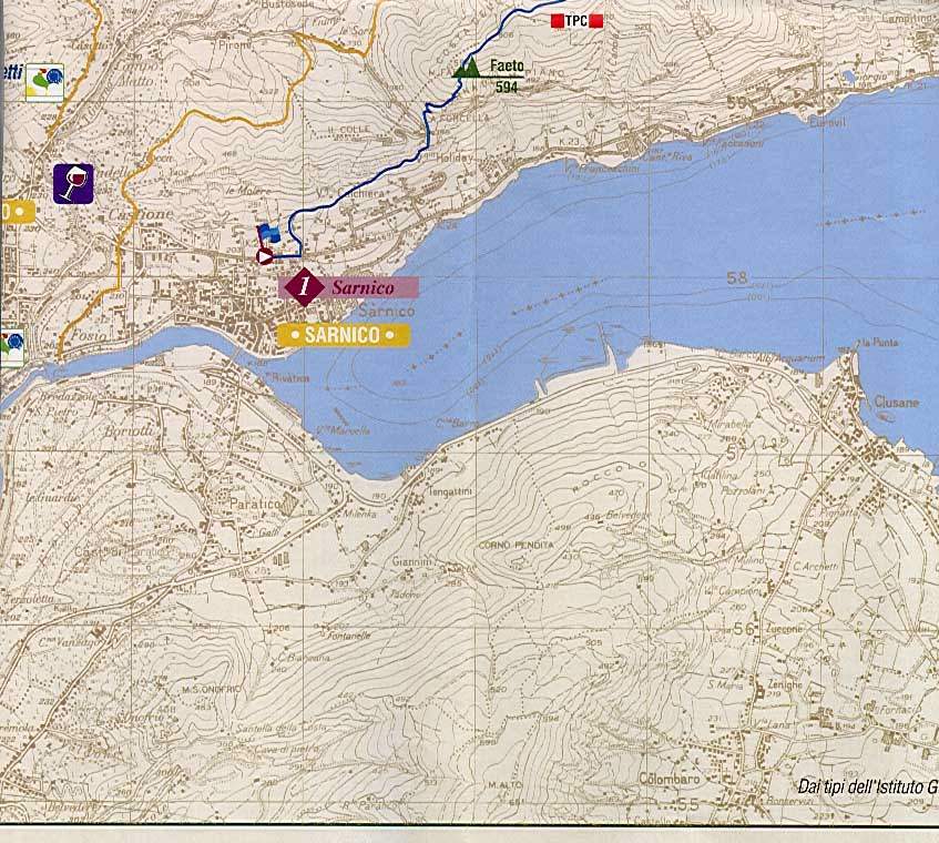
Path from Sarnico to Monte Bronzone
- Length: 17 km
- Walking time: 5 hours and 30
- Markers: TPC - 701 - 728 - 729
- Difficulty: Hikers
- Water: NO
- Altitude difference: 1230 mt
- Reasons of interest: naturalistic, historical, landscape
The route that we propose is divided largely on the Trans Padano Centrale (TPC) and, for the circumnavigation of Mount Bronzone, on path 701, the main axis of all the hiking trails in the area.
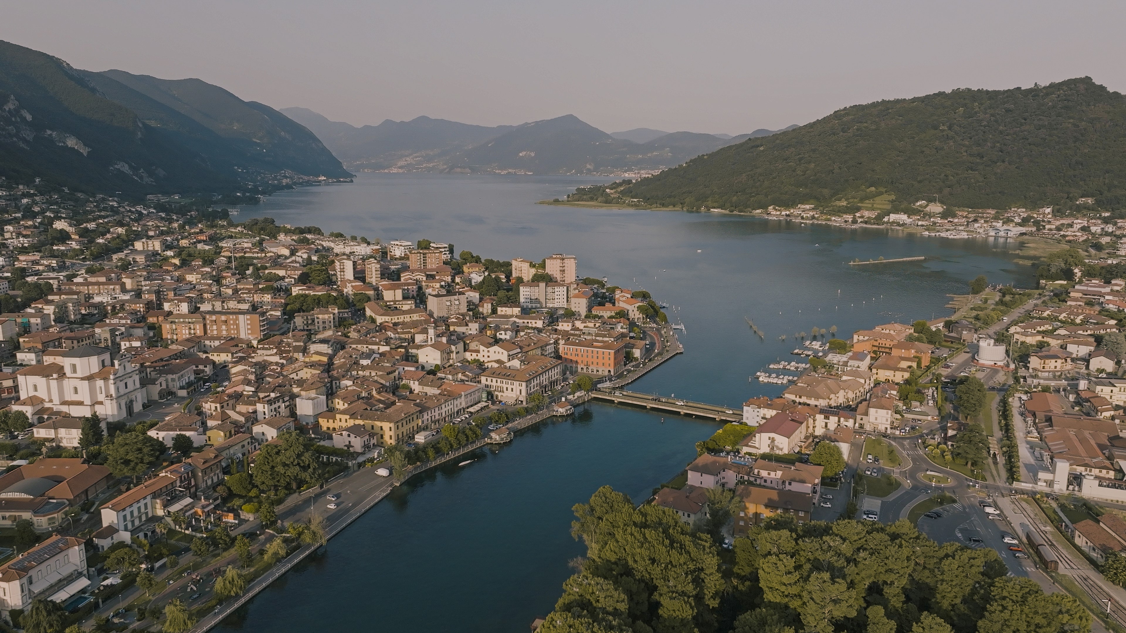
Just arrive in Sarnico, after the Monumental Cemetery follow signs for the Alpine Chapel; at the first hairpin bend, where the climb begins to become steeper, you park in the square on the right in front of the covered passage with TPC signs.
After a few meters, at the first junction for the Alpine church, continue straight on a comfortable flat path between the dry sandstone walls of Sarnico, up to the aqueduct building that you pass following the obvious path. Continue past a group of houses, then right downhill for a few meters on a paved road and immediately left for a steep concrete path (TPC).
After a short uphill on a dirt road you enter on a steep paved road; on the left (TPC) starts a path bordered by dry stone walls. After the barrier, continue on the path called "Percorso della Madonna", in the shade of olive trees and cypresses, which gives a typical Mediterranean atmosphere to the surrounding environment.
The path is comfortable and well marked and only the echo of traffic recalls the nearby Sarnico with the crowded lakefront.
After reaching the pleasant Chapel consecrated to the Virgin, altitude 398 m, 20 minutes from the start, you walk on the beautiful and well-preserved paved path, with steps in sandstone of Sarnico, and side ruts in cobblestone for the passage of carts.
Shortly reaching the junction of the Forcella, turn right (TPC), following a path that goes into the woods, in a scenario increasingly interesting, both from the point of view of landscape and nature.
Continue on the slopes of Monte Faeto and, having reached the ruins of a farmhouse, the path allows some flat stretches.
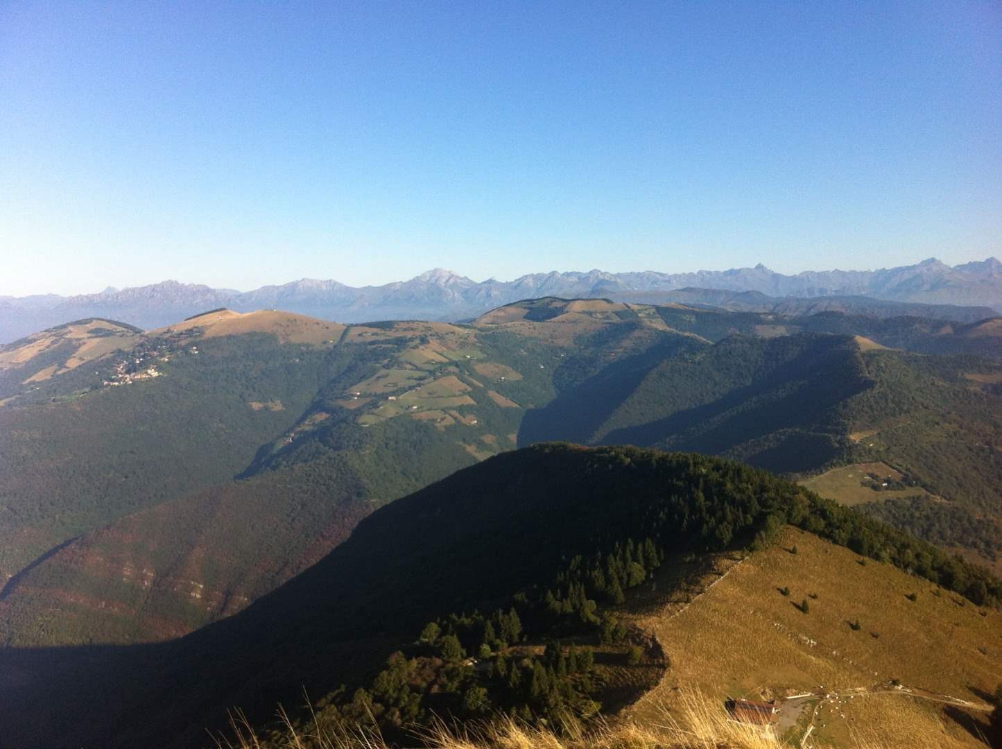
After about half an hour from the Forcella, turn left following the signpost (TPC) and take a comfortable dirt road on the ridge near Colle Cambline, 772 m and 1 hour from the start, characterized by the wide open spaces and the view of the Bronzone, the Guerna Valley and of course, the lake with the peat bogs of Iseo.
From the hill, left on the right the Corno Buco that dominates Predore, go down on the dirt road that leads to Lerano, an ancient rural nucleus now a hamlet of Viadanica; at the junction turn right slightly uphill.
Continue on wide hairpin bends (TPC), in an environment that has kept intact its agricultural vocation; after the pitch with the signs for the take-off of paragliding, continue on the path indicated by the marble cypress and you go into a beautiful mixed forest of Castani, Birches and with a surprising number of holly, sometimes of considerable size.
At the first junction follow the trail (TPC) on the right, then pass a hunting hut with a puddle, and you reach the Col d'Oregia, 940 m and hour 45 from the start, an important crossroads of hiking trails.
Paying attention to the signposts, keep to the right following double signaling TPC-701 towards Rolla.
Near a very well-kept hut, follow on the left the obvious signs for the Bronzone (701); the path runs flat among exceptional examples of Agrifogli, then again a short climb and you enter a dirt road, which leads to the limestone cliffs of Dolomia in Conchodon, a rugged and still wild environment.
Near a farmhouse, the road gives way to a path (701) well signposted but with steep sections, which goes into the bush on the rocky slopes of the Bronzone, flooded in summer by the penetrating scent of cyclamen.
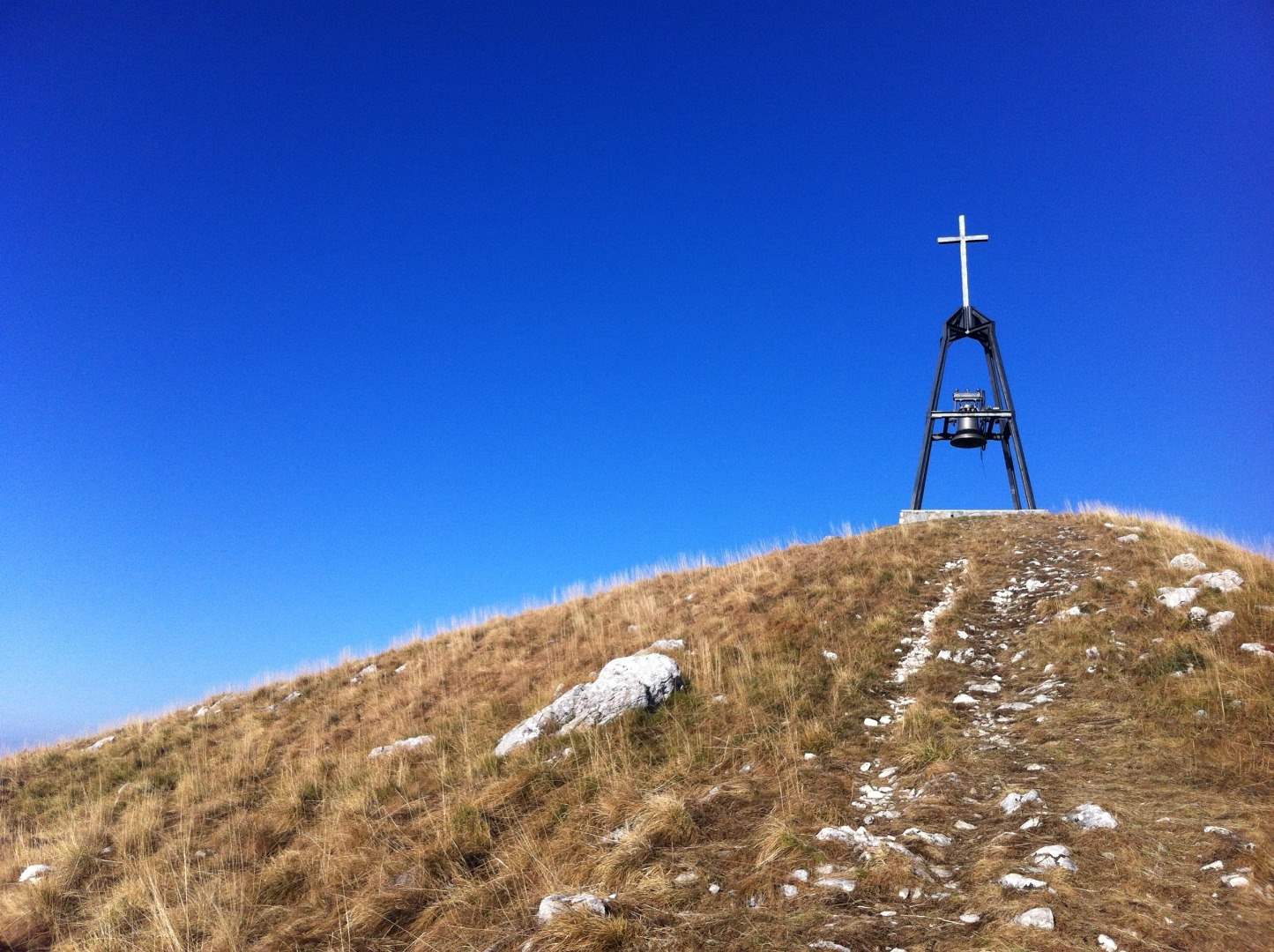
Once near the summit clearings, leave on the left the 701 and continue on an obvious track, which leads with a last tiring climb up to the summit cross, 1334 m and 3 hours and 30 from the start.
Here the panorama repays the effort spent: the view ranges undisturbed at 360, including to the east the basin of Lake Iseo, Montisola, the Corna dei Trenta Passi, the Guglielmo; to the north the nearby Colli di S. Fermo, Parzanica and Vigolo, the Prealpi Orobiche and the Val Camonica; to the west the Misma and the Cavallina Valley, including, to the south, on clear days the Po Valley and the Apennines.
For the return ride along the last stretch up to 701 and continue left, to complete the tour around the Bronzone with a simple and rewarding path, which leads in short to the Gombo, 1168 m, site of historical findings and now seasonal mountain hut, crossing the suggestive north side of the mountain.
Once you reach the steep grassy slope near the farmhouse you will find the trail of the path that descends towards the basin of Vigolo; on clear days the view allows you to appreciate the size of Montisola and the cup curve of glacial erosion.
Once you get off at the low hut of Gombo, you will find the CAI trail markers of trail 728; you will pass the intersection with the TPC and you will enter the dense beech forest, where with a little attention you can spot the signs of the presence of many animals, including ungulates and wild boars.
The path, well signposted, goes around the eastern side of the Bronzone, covered by a thick Bush, and soon leads to a clearing where you find on the right the junction with the path 729.
Cross a broad-leaved wood in which some splendid beech trees dominate and reach the hut under Colle La Rolla, 970 m, and retrace back the 701 and the TPC until the start.
Texts and images from the site www.bronzone.it
Comunità Montana Monte Bronzone e Basso Sebino
FOR MORE INFORMATION CLICK HERE